 Montevideo City Guide
Montevideo Map: Every Pin, Colour and Barrio
This Montevideo map holds about 40 pins in five colours: the old town, the city sights, the beaches, the arrival points and the day trips out of town. Each pin has a note on this page, and the text explains how the city is shaped so you can read the map instead of memorising it. Start with the shortlist below, read the full list of Montevideo attractions, or let one of the Montevideo tours do the driving.
Quick answer How the city is laid out, in four lines
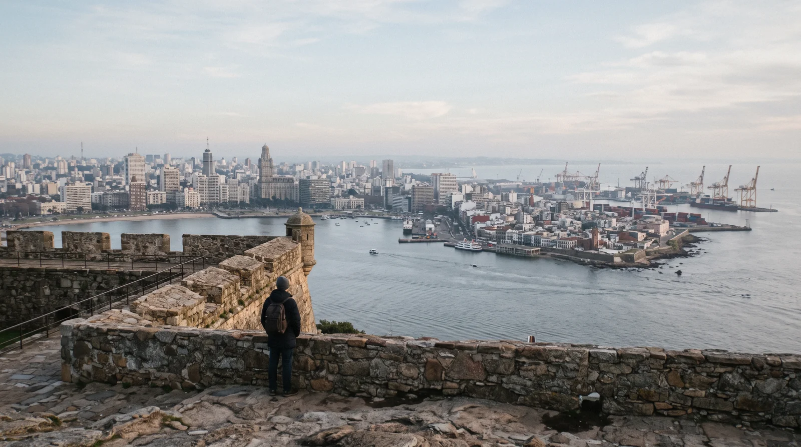
Montevideo is a line, not a grid. The Rambla runs almost 30 km along the Río de la Plata, by the city tourism office's count, from the old port peninsula in the west to Carrasco and the airport in the east. The Old Town sits beside the port at the west end. The Cerro, a 135 m hill with a fortress on top, stands across the bay.
Key takeaways
- The Old Town peninsula is the densest cluster of pins and the best place to walk. Start at Plaza Independencia and work through Ciudad Vieja, or take the Ciudad Vieja walking tour.
- The coast is a single line, so cover it by bike or bus. The hop-on hop-off bus traces the Rambla, and you can read more about the waterfront at the Rambla.
- Arrival points sit on the same map: the port for cruise and ferry passengers, Tres Cruces for long-distance buses, and Carrasco airport at the east end. See the cruise port if you arrive by ship.
- Where you base decides your day. The peninsula puts you among the sights, Pocitos puts you near the beach. Compare options on Montevideo hotels.
The Montevideo Map
43 pins in five colours, placed from Wikidata and OpenStreetMap coordinates. Red is the Old Town peninsula, blue the city sights inland and along the coast, gold the beaches west to east, green the three arrival points, purple the day trips. Tap a pin for its note, or use the numbered list under the map.
Old Town Peninsula 14 pins
- Mercado del PuertoThe 1868 iron market hall made in Liverpool, now grill restaurants. Hours are each restaurant's own.
- Plaza IndependenciaFreeThe main square between the Old Town and Centro, above Artigas's mausoleum.
- Puerta de la CiudadelaFreeThe one surviving gate of the Spanish wall, where the free walking tour meets at 10:30.
- Artigas MausoleumThe underground tomb of José Artigas beneath Plaza Independencia, included on the paid Ciudad Vieja walk.
- Palacio SalvoThe 1928 tower on the square, 105 m to the beacon, built where La Cumparsita was first played in 1917.
- Teatro SolísOpened 1856, rebuilt 1998-2004: Uruguay's main stage, beside the square.
- Metropolitan CathedralThe cathedral on Plaza Matriz, the old colonial main square at the far end of Sarandí.
- CabildoThe colonial town hall, built 1804-1812, now a museum on Plaza Matriz.
- Museo Torres GarcíaThe painter Joaquín Torres García's museum, on Sarandí inside the gate.
- Museo Andes 1972$8The memorial museum to the 1972 Andes crash at Rincón 619, closed on Sundays.
- MAPIPre-Columbian and indigenous art at 25 de Mayo 279, free on Mondays.
- Palacio TarancoDecorative arts in a palace on the site of the first theatre, Tuesday-Saturday 11:00-18:00.
- Museo del CarnavalThe carnival museum by the port, beside Mercado del Puerto.
- Museo GurvichThe Museo Gurvich, an art museum on Plaza Matriz.
City Sights 11 pins
- Palacio LegislativoThe seat of Parliament, a stop on the hop-on bus Tour Central.
- Palacio MunicipalCity hall on 18 de Julio, with a 77 m panoramic lookout and a hop-on bus stop.
- Estadio CentenarioOpened 18 July 1930 for the first World Cup. FIFA's first Historical Monument of World Football.
- Museo del FútbolUnder the Torre de los Homenajes: Monday-Saturday 10:00-17:00, Sunday 11:00-15:00, closed on match days.
- MNAVFreeThe national art museum in Parque Rodó, free, Tuesday-Sunday 13:00-20:00.
- Parque RodóFreeA 43-hectare park with a lake opposite Playa Ramírez. Sunday fair 9:00-15:30.
- Japanese Garden, PradoFreeInside the 106-hectare Prado park with the Botanical Garden and the rose garden.
- Castillo PittamiglioAn alchemist's castle on the Rambla, begun 1920. Tuesday-Friday 11:00-17:00, weekends 15:30-19:30.
- Punta Carretas LighthouseFreeThe 21 m lighthouse at the southernmost point of Montevideo.
- Feria de Tristán NarvajaFreeThe Sunday street fair since 1909, from 9:00 to about 16:00.
- Fortaleza del CerroThe fort on the 135 m hill across the bay. Museum every day 10:00-18:00.
Beaches 9 pins
- Playa de Pajas BlancasFreeWild coast west of the Cerro with artisanal fishing. No toilet.
- Playa del CerroFreeThe old workers' beach on the west side, with amphibious chairs and an accessible toilet in summer.
- Playa RamírezFreeThe family beach opposite Parque Rodó. Lifeguards in spring and summer only.
- Playa PocitosFreeRuns the full length of Rambla República del Perú, with a boardwalk and amphibious chairs.
- Puerto del BuceoA marina, not a beach: the Intendencia never opens it for bathing.
- Playa BuceoFreeOne of the 19 beaches whose water the city monitors in season.
- Playa MalvínFreeWider, with clearer water and the Isla de las Gaviotas offshore.
- Playa VerdeFreeGood for bathing but with rougher waves, often surfed.
- Playa CarrascoFreeThe beach of the Carrasco barrio, near the airport end of the Rambla.
Arrival Points 3 pins
- Port of MontevideoWhere cruise ships dock in summer, beside the Old Town.
- Tres Cruces Bus TerminalThe country's main bus terminal, for Punta del Este, Colonia and Brazil or Argentina.
- Carrasco International AirportAbout 20-30 minutes to the centre by the city tourism office's estimate.
Out of Town 6 pins
- Colonia del Sacramento$60The Portuguese town of 1680, its historic quarter on UNESCO's World Heritage list.
- Bodega Bouza$95A winery in the hills north-west of the centre, visited on a tasting tour.
- AtlántidaCosta de Oro resort 45 km east, with Eladio Dieste's church.
- PiriápolisThe 1890 resort of Francisco Piria, about 100 km east.
- CasapuebloPáez Vilaró's white house at Punta Ballena, 13 km from Punta del Este.
- Punta del Este$41The Atlantic resort about 140 km east, with La Mano on the beach.
Shortlist: Six Pins Worth a Short Visit
If the map is too much at once, these six pins carry most of a first visit, chosen for what each gives that the others do not. Hours are the venues' own.
| Pin | Colour | Cost | Why It Is on the Shortlist |
|---|---|---|---|
| Puerta de la Ciudadela | Old Town (red) | Free | The one gate left of the Spanish wall, and the start of every Old Town walk |
| Palacio Salvo | Old Town (red) | Official guided ticket, $16 | The 1928 tower on the square, visited inside in one hour |
| Mercado del Puerto | Old Town (red) | Your lunch | The 1868 iron hall by the port, and stop 1 of the hop-on bus |
| Parque Rodó and MNAV | City sights (blue) | Free | The national art museum and a lake opposite Playa Ramírez in one stop |
| Playa Pocitos | Beaches (gold) | Free | The beach barrio, with the Montevideo letters above the sand |
| Fortaleza del Cerro | City sights (blue) | Paid entry | The view back across the bay to the whole city |
What the Colours Encode
Five colours sort the pins by the role they play in a trip, not by what kind of thing they are.
Most city maps sort by type: all museums together, all beaches together, all monuments together. That helps a librarian and confuses a visitor on a two-day trip. This Montevideo city map sorts by role instead.
The old town colour groups everything you can reach on foot between breakfast and dinner on day one. The city sights colour holds the places that need a bus, a taxi or a deliberate trip inland, like the Palacio Legislativo or the Estadio Centenario. The beach colour runs west to east along the river, in the order the coast road passes them.
The arrival points colour shows where each day starts: the port if you come off a cruise ship, Tres Cruces if you arrive by long-distance bus, the airport if you fly in. The out of town colour sits at the edges of the map, because those places cost a half day or a full day each. If you want the words behind the pins, things to do in Montevideo carries the full list, and the Montevideo tours page shows who will take you round.
How Montevideo Is Shaped
Three shapes cover the whole map: a peninsula, a line and a hill.
The Port Peninsula
Montevideo began in 1724 as a walled Spanish fortress town called San Felipe y Santiago, guarded by a citadel. The wall came down by 1829, and only the Puerta de la Ciudadela survives, standing today between Plaza Independencia and the Sarandí pedestrian street. Everything that mattered to the first visitors still sits inside the old footprint: Plaza Independencia with Palacio Salvo, Teatro Solís, the Cathedral, the Cabildo, the Mercado del Puerto and a handful of small museums.
The commercial port lies right beside it, which is why cruise passengers step off the ship straight into the Old Town. This is the densest patch on any map of Montevideo, and it is the part of the city where walking beats every other form of transport. Read the full Old Town guide at Plaza Independencia and plan the rest of your pins from there.
The Coastal Line
Rambla Sur was officially inaugurated on 30 December 1935, and its construction cleared about thirty blocks between calle Reconquista and the sea, a loss remembered in the tango Adiós mi barrio. From that start the Rambla grew into the single unbroken waterfront promenade that today carries the city east: Parque Rodó first, then Punta Carretas, whose lighthouse stands 21 m high at the southernmost point of Montevideo, then Pocitos, Buceo, Malvín, Punta Gorda and finally Carrasco, where the monumental Hotel Casino Carrasco stands near the airport end. On the map this reads as one straight coastal line with beaches strung along it like beads, and the beach colour pins follow that order from west to east.
Each barrio has its own character, so read Punta Carretas and Pocitos before you decide which stretch to base on.
Inland and Across the Bay
Turn inland from the coast and the map fills in along Avenida 18 de Julio, the city's main axis. The Palacio Legislativo, Uruguay's parliament building, stands at the inland end of the avenue's district, and the Palacio Legislativo page explains how to visit it. Further east, Parque Batlle covers 60 hectares and holds the Estadio Centenario, opened on 18 July 1930 for the first World Cup, which Uruguay won.
North of the centre the Prado park offers 106 hectares of 19th-century villas, a botanical garden and a Japanese garden. Across the bay to the west rises the Cerro, a 135 m hill crowned by the Fortaleza General Artigas, the last Spanish fort built in Uruguay, with a military history museum and the first lighthouse of the Río de la Plata. The Fortaleza del Cerro page has the visiting details, and from the fortress the view takes in the bay, the port, Centro and the Old Town.
Source: Casco Histórico, Rambla Sur, El Cerro de Montevideo, Ciudad Vieja, Wikipedia.
Is Montevideo Walkable?
Yes in the old town, partially along the coast, and no as a whole.
The Old Town is genuinely walkable. Its pins cluster within a few blocks of each other, the Sarandí pedestrian street links Plaza Independencia to Plaza Matriz, and a guided option such as the Ciudad Vieja walking tour covers the whole quarter on foot in one morning. The coastal line is a different matter.
Almost 30 km of Rambla, by the city tourism office's count, makes a wonderful walk in sections and an exhausting one end to end, so treat it as several short walks rather than one. The city bus fills the gaps: a one-hour ticket costs $1.29 (UYU 52) with an STM card or $1.59 (UYU 64) cash, and cash costs about 23 percent more, so get a card. The hop-on hop-off bus runs two circuits covering the same ground with commentary for a day. Bikes suit the Rambla promenade, and the small-group bike tour with picnic or the e-bike tour turns the coastal line into a half day.
On safety, the UK FCDO advises avoiding walking alone downtown or in the port area at night and on weekends, advice worth reading at is Montevideo safe.
The Gaps, and Why Each One Is a Finding
What the map leaves off is as useful as what it puts on.
- The Intendencia never opens three spots for bathing: Playa del Gas, Puerto del Buceo and Miramar. Puerto del Buceo is a marina, so there is nothing to swim from. None of the three appears on a tourist map, and that absence tells you the swimming pins stop where the sand and the lifeguards stop. - There are no restaurant or hotel pins here.
Named food and lodging only earn a place when a citable source backs them, so this page keeps the map honest and leaves meals to the Montevideo restaurants hub. - The candombe drum routes have no pin, because they move. The comparsas of Barrio Sur and Palermo rehearse and parade through their own streets, and the rhythm that UNESCO recognises as heritage cannot be fixed to a dot. Read candombe and go on foot. - The Sunday Tristán Narvaja fair is a street, not a point.
It runs along Tristán Narvaja itself in Cordón from about 9:00 to about 16:00, so a single marker would mislead. See Montevideo shopping for how to work it.
Source: Estado de playas, Intendencia de Montevideo, Barrio Sur y Palermo, Feria de Tristán Narvaja.
What the Season Changes on the Map
The same pins behave differently depending on the month you visit.
The beach pins change meaning with the calendar. During beach season the lifeguarded beaches are flagged as fit or unfit for bathing, and the Intendencia keeps a live map with condition flags, a water-quality layer and the UV index on montevideo.gub.uy. Outside the season there are no lifeguards and no sea-condition information at all, so a summer pin and a winter pin are two different facts.
Cruise ships dock at the port in summer, right beside the Old Town pins. Winter runs from June to August and is cold, damp and windy, which shortens the time you want to spend on the open coastal pins. Carnaval runs about forty days from late January, and its parades and rehearsals redraw parts of the evening map entirely.
The practical pages for this are Montevideo beaches, Montevideo weather and Uruguay's carnival.
The Official Map
For street-level detail the Intendencia publishes its own interactive map, MonteviMap, built for desktop browsers. Use it for addresses and city services, and this page for the order of a visit: which pins sit together, which need a bus and which only work on a given day of the week.
Source: Estado de playas, Intendencia de Montevideo, Descubrí Montevideo, by sea.
See the Map From a Seat or a Saddle
The hop-on bus runs both halves of the map, the Old Town walk covers the red pins and the bikes ride the coast.
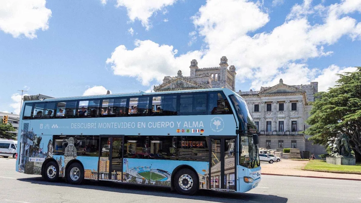 from $25
Montevideo: Sightseeing Hop-On Hop-Off Bus Tour
The cheapest city overview in Montevideo, a two-circuit 24-hour hop-on hop-off pass with audio guide for $25.
Check Availability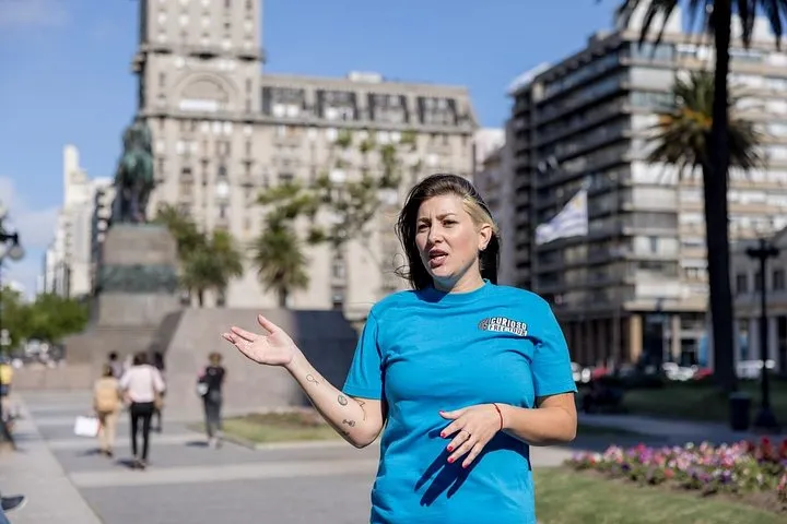 from $20
Historical and Cultural Tour of Montevideo Discover Old Town
A 2.5 hour guided walking tour of Montevideo's Old City with entry to three sights included for $20.
Check Availability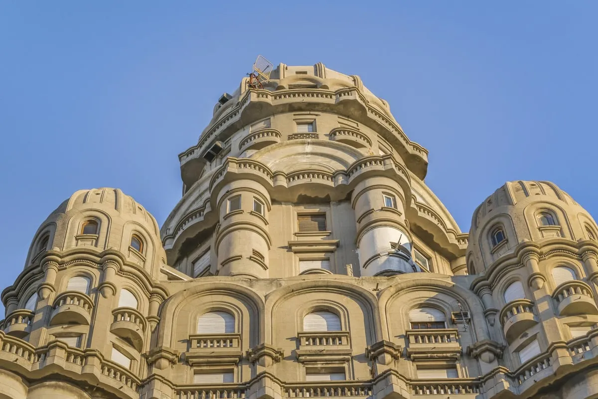 from $16
Montevideo: Palacio Salvo Official Ticket with Guided Tour
An official one-hour Spanish guided tour of Palacio Salvo ending at the top-floor viewpoint, from $16 per person.
Check Availability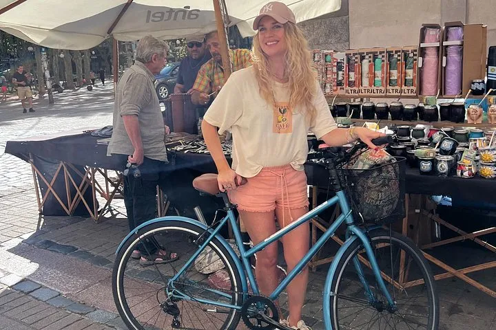 from $55
Montevideo Small Group Bike Tour or E-bike tour with picnic
Small-group bike or e-bike ride through Ciudad Vieja and the Rambla with a picnic at the end, capped at 6 riders.
Check Availability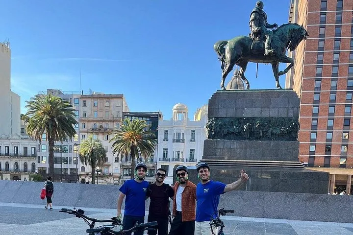 from $69
Montevideo Electric Bicycle Tour
A private 3-hour e-bike ride with Beetour covering Montevideo's landmarks, rated 5 from 213 reviews, at $69 per person.
Check AvailabilityThe full set of guided options is on the Montevideo tours page. Figures current {checked}.
Prices, ratings and details are the platform's own. Dollar figures are the listed prices. The platform bills in your account's currency.
Where to Go Next
The pages that put the pins in order.
Things to Do in Montevideo
The same sights as a numbered list with hours, sorted by area and by day of the week.
Montevideo Map: Questions
Where is Montevideo located?
Montevideo is the capital of Uruguay and sits on the north bank of the Río de la Plata, the wide estuary that reads like the sea on the horizon. On a map of South America it faces Buenos Aires across the water, a ferry ride away. It is not Montevideo, Minnesota, which is a small town in the United States. Start planning with what to see in Montevideo.
Is Montevideo a walkable city?
The Old Town peninsula is fully walkable, and most first-day pins sit within a few blocks of Plaza Independencia. The city as a whole is a line almost 30 km long along the Rambla, so walking works in sections but not end to end. City buses cover the gaps, and bikes suit the flat coast. Details on getting around safely are on is Montevideo safe.
Is there an official Montevideo city map?
Yes. The Intendencia, the city government, publishes MonteviMap, its own interactive map, on montevideo.gub.uy, and it works in desktop browsers. This page complements it with a traveller-oriented set of pins, and the hop-on hop-off bus ticket includes a printed city map of its own.
Where is the airport on the Montevideo map?
Carrasco International Airport sits at the far east end of the coastal line, past all the beach barrios, in the Carrasco barrio that gives it its name. It is the last arrival pin on the east of the map, and the drive into the centre takes roughly 20 to 30 minutes according to the city's tourism site. Read the arrival options at Carrasco airport.
How far is the Old Town from the beaches?
The two sit at opposite ends of the beach stretch, with the old town on the west peninsula beside the port and Pocitos several barrios east along the Rambla. The practical answer is not to walk it: take a city bus, or ride the hop-on hop-off bus, whose Rambla circuit stops in Pocitos and whose Central circuit starts at Mercado del Puerto in the old town.
What is Montevideo most famous for?
For its old port quarter with the Mercado del Puerto and its grill restaurants, for the Rambla promenade, for the Estadio Centenario, built for the first World Cup in 1930, and for candombe, the drum rhythm recognised by UNESCO. The beach barrios and the Sunday Tristán Narvaja fair add their own pull. The full list is on things to do in Montevideo.
Montevideo's Barrios on Film
Three looks at how the city divides, barrio by barrio.
An Immigrant's Guide to Montevideo Neighborhoods
A guide to the barrios, from the Old Town to the coast.
Video: Cassie the English TeacherBest Areas to Live in Montevideo Uruguay in 2025
Which areas people choose to live in, and why, along the same coastal line.
Video: Living in Latin AmericaMontevideo City Video Guide | Expedia
A short video tour of the city's main districts.
Video: expediaseaVideos load from YouTube only when you press play.
Prices, hours and terms are set by the venue or operator and confirmed at checkout.
We may earn a commission if you book through one of our links, at no extra cost to you. Full affiliate disclosure